MAXIM860
MAXIM860 – Next-Generation Aerial Mapping and 3D Modeling Solution
Revolutionizing Aerial Photogrammetry and 3D Reconstruction
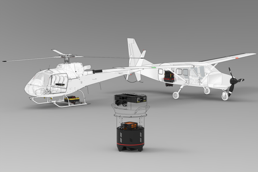
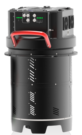
The MAXIM860 is a cutting-edge 860 MP Airborne Mapping System designed for large-scale photogrammetric 3D cluster modeling. Compatible with both fixed-wing aircraft and helicopters, the MAXIM860 delivers unparalleled precision and efficiency in aerial mapping and 3D reconstruction.
Key Features
High-Resolution Imaging:
Capture the Earth’s surface in stunning detail with 860 MP aerial photography, enabling the creation of Digital Surface Models (DSM) and Digital Orthophoto Maps (DOM).
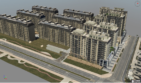
Advanced 3D Cluster Modelling:
Generate highly accurate 3D models of terrain, buildings, trees, and other features with our state-of-the-art photogrammetric software.
Large-Scale Aerial Triangulation: Achieve a 99%+ successful calculation rate with stable and efficient aerial triangulation, even for massive datasets.
No Data Limits:
Overcome traditional limitations with multi-block union and multi-machine parallel processing, ensuring seamless integration of large-scale projects.
Versatile Usage: Perfectly suited for both fixed-wing and helicopter operations, making it ideal for a wide range of aerial mapping applications.
Applications
Topographic Mapping: Create detailed Digital Surface Models (DSM) that include all surface objects such as trees, buildings, and other features.
Orthophoto Generation: Produce Digital Orthophoto Maps (DOM) through orthogonal projection, radiation correction, and mosaicking of aerial images.
3D Reconstruction: Build high-quality 3D cluster models for urban planning, environmental monitoring, and infrastructure development.
Why Choose MAXIM860?
Unmatched Precision
With a 99%+ success rate in aerial triangulation, the MAXIM860 ensures reliable and accurate results every time.
Scalability
Handle projects of any size with no data limits and multi-machine parallel processing, boosting efficiency by up to 200%.
Ease of Use
The intuitive software interface and advanced features like multi-block union eliminate the need for connection points between blocks, simplifying complex projects.
Unlock the Power of Aerial Mapping with MAXIM860
Whether you’re mapping vast terrains or creating detailed 3D models, the MAXIM860 is your ultimate solution for large-scale photogrammetry and 3D reconstruction. Experience the next generation of aerial mapping technology today.
Contact us for more information:
Info@Arantechsolution.com